Plane Spotting with Pi and Amazon Alexa
Plane spotting, like train spotting, is a hobby enjoyed by many a tech enthusiast. Nick Sypteras has built a voice-controlled plane identifier using a Raspberry Pi and an Amazon Echo Dot.
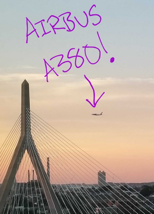
“Look! Up in the sky! It’s a bird! It’s a plane! No, it’s Superm- hang on…it’s definitely a plane.”
What plane is that?
There’s a great write-up on Nick’s blog describing how he went about this. In addition to the Pi and the Echo, all he needed was a radio receiver to pick up signals from individual planes. So he bought an RTL-SDR USB dongle to pick up ADS-B broadcasts.
With the help of open-source software he can convert aircraft broadcasts into JSON data, which is stored on the Pi. Included in the broadcast is each passing plane’s unique ICAO code. Using this identifier, he looks up model, operator, and registration number in a data set of possible aircraft which he downloaded and stored on the Pi as a Mongo database.
Where is that plane going?
His Python script, with the help of the Beautiful Soup package, parses the FlightRadar24 website to find out the origin and destination of each plane. Nick also created a Node.js server in which all this data is stored in human-readable language to be accessed by Alexa.
Finally, it was a matter of setting up a new skill on the Alexa Skills Kit dashboard so that it would query the Pi in response to the right voice command.
Pretty neat, huh?

Plane spotting is serious business
Nick has made all his code available on GitHub, so head on over if this make has piqued your interest. He mentions that the radio receiver he uses picks up most unencrypted broadcasts, so you could adapt his build for other purposes as well.
Boost your hobby with the Pi
We’ve seen many builds by makers who have pushed their hobby to the next level with the help of the Pi, whether it’s astronomy, high-altitude ballooning, or making music. What hobby do you have that the Pi could improve? Let us know in the comments.


16 comments
Mark
Scary that you can so easily and cheaply identify planes like this in today’s world. I’m saying nothing more!
James
Why is that scary? Who and how could anyone achieve anything malevolent with that information?
Mark
James: If you can’t figure it out, I’m not about to explain it to you. Think about it for a while and maybe the penny will drop. I don’t explain things like this in public forums on the internet!!
Joel Potischman
Mark, I believe James’s point is that sure there are bad actors who’d love to blow up a plane but it’s hard to see how knowing flight details about a plane overhead makes it any easier to attack it, and in any event you have been able to get absolutely all of this information from a large number of public sources for years. If I wanted to blow up a *particular* plane this might make it ever so slightly faster and more convenient for me to know if I found the right one, but he (and I) don’t see how this makes it even 0.1% easier or more likely for an attack to be carried out.
If you think you have identified a credible way that this provides or contributes to an attack vector against planes, though, please share it. Security is *improved* when these things are discussed in public forums on the internet!
Mark
Joel: I am guessing that you are ex-military – I could, of course, be wrong, but I accept that. It is well known that when things are discussed openly it can initiate actions by others who have not yet had the idea. This is why patentable ideas are NEVER discussed openly before the patent is applied for. I will give you and Chris Smith a single example of why I know that it is incorrect for me to discuss ideas for terrorist activities in public. When a newspaper publishes a story about a crime commuted in a novel and innovative way, a series of copycat crimes usually follow in rapid succession. You may recall the use of superglue by a criminal who held up a shopkeeper by gluing his hands to the counter top and then proceeded to empty his cash register. Ingenious! Nobody appeared to have had this idea before, yet once it was published, there followed a long series of copycat crimes using the same “attack vector” if I may borrow your term! This was simply due to the tabloid press performing their “duty” and reporting the crime, along with full details of how it was comitted.
My apologies to all if I have offended your sensibilities by failing to pass further comment on how terrorists might adapt any information herein, but I would rather not aid or abet them in their nefarious endeavours. I also do not wish to prolong this “off-topic” discussion any further, so will not respond to further comments and, instead, will get on with my paid work.
Chris Smith
Mark
There are several sources of this information – FlightRadar24 being just one. I am a contributor of data to that supplier.
ADSB data will eventually replace secondary RADAR. It is a fact of life that this data is readily available and, like James, I can see nothing scary in it.
Perhaps you should also think about it for a while before letting your imagination run riot.
Joel Potischman
Mark, I’ll let this be my last comment as well. My point is that this information, which again, has been publicly available for decades and needs to be so for the safe operation of the commercial aviation industry, simply doesn’t help anyone commit an attack. If I already have a surface-to-air missile, believe me, this app isn’t the long-missing final piece of my plot. If you’re suggesting that someone could use the transponder data to target a missile onto a plane (terrorists, please don’t read that), a) remember that they’ve been able to do this for decades, and b) this data wouldn’t be remotely precise or recent enough anyway for a missile to actually find the plane, as evidenced by the zero times such an attack has been tried.
Mark I definitely agree with you that there are plenty of examples of public data being used for evil in unanticipated ways and I appreciate you being thoughtful about what you post for those reasons. I just don’t think this is one of those examples. I think this is a cool project for aviation buffs, of no use to terrorists, and I may build it with my plane-loving son. And I will be precisely 0.00000% more nervous next time I fly knowing people are asking Alexa to identify my plane.
I’ll get back to my paid work now too. And just for the record, I’m not (ex-)military.
Cheers,
-joel
Dougie Lawson
Oh dear the paranoia is strong in this one.
Do you assume that everyone has a fully programmable surface to air missile hidden in their loft? Because that’s just not true (note: it may be true in America where everyone seems to be armed to the full extent of their first amendment rights).
What possible harm does it do for me to know that BA238 is flying over my house from Boston (BOS) en-route to Heathrow (LHR)?
Jay Gould
I’m American. Stop peeking in my loft!;)
Raspberry Pi Staff Simon Long
http://www.nats.aero/ae-home/ is a free application from NATS which provides exactly the same information.
NATS, for those who’ve never heard of it, is the UK’s National Air Traffic Services, which manages the UK’s airspace – it controls all the civil traffic in the air lanes above the UK and at 14 of the UK’s airports.
If the organisation which is responsible for the management of air traffic in the UK is happy to publish this information, I think it’s a pretty fair assumption that they can’t think of anything unsafe in doing so, and if they can’t, then there probably really isn’t anything unsafe about it…
Frank Reijn
I have Domoticz running on my Pi and a Flightaware ADS-B on a separate Pi. When an airplane flies into my 10km zone (around my city) it reports this into my domoticz system. Made separate counters for Police and Resque Helicopters. Let me know if you are interested, i can share the details.
Melina
Frank Reijn I am interested in your project!
Matt Richardson
At the SF office, we have a line-of-sight to SFO. Here are the planes we’ve been tracking: http://flightaware.com/adsb/stats/user/mrichardson23
Erik Lacson
I just started a similar project his week and was happy to read about this one. I’m also using dump1090 with an RTL-SDR dongle on a Pi 3. Mapping and visualization via VirtualRadar running on Windows, which connects to the Pi/dump1090 set-up via HTTP.
It’s clever to include voice in this project.
Jan Zumwalt
Poor Mark… Instead of jumping on the guys back (obviously not acquainted with aviation, wouldn’t it be better to help educate?
Mark aircraft information has been made available primarily for travelers (or at least the people that need to pick someone up at the airport) i.e. FlightRadar24
Experimental aircraft pilots have been home brewing anti-collision electronics to do this for years. A project that can use a $5 pi zero micro-controller is here. https://flightaware.com/adsb/piaware/build
Technology evolves; accurate GPS was kept from the public until the first Iraq war. Then it was forced “public” by the needs of civilian contractors both in the air and on the ground supporting the military. Once that happened, it made it into our cell phones, backpacks, cars, and model airplanes. In the 70s & 80s, the military was scared to death how easy a “missile” could be guided with GPS. 911 showed us, GPS was not needed!
Mike Morrow
Way simpler way to do this. Only the Pi and SDR needed. No java or python or json or any of that. There are 2 main services and they produce all this data on a machine with a web browser that connects to the proper port. It is all right there. I have been doing it for a year. FlightRadar24 and FlightAware are the places to start. Otherwise, nice project but a whole lot of trouble.
Comments are closed